
Forests and Rangelands Success Story
One Year Prescribed Fire Scars Help Firefighters Contain Fire
Everglades National Park, Florida
National Fire Plan - Firefighting
2008
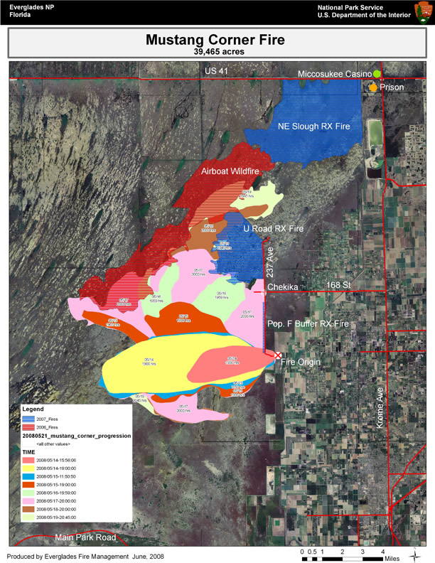
Daily progression map with 2007 prescribed fires and 2006 Airboat wildfire. Map by Maya Vaidya, NPS, Everglades National Park.
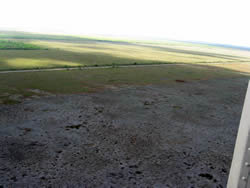
Aerial view of Mustang Corner Fire where it ran into the Population F Buffer prescribed fire area. NPS photo by Robert Trincado.
The Mustang Corner Fire began on May 14, 2008, in extremely dry saw grass prairie fuels, going on 30 days with no rain. Primarily a wind-driven fire, rough terrain, and extreme fire behavior made control efforts difficult for ground crews. Aerial resources along with the ground crews made good progress, but the fire was still rapidly consuming the habitat of the federally listed Cape Sable Seaside Sparrow (CSSS). This fast moving fire also jeopardized cultural resources and park structures as well as homes, prisons and other structures within the wildland-urban interface adjacent to the park’s eastern boundary.
Reduced fuel loading from recent fires gave firefighters great assistance in containing the blaze. On the northeast side of the Mustang Corner Fire, the decreased fuel loads from the Airboat and U-Road fires significantly slowed the progress of the fire and provided enough time for firefighting tactics to contain effectively the edge at the perimeter it reached on May 19. The Northeast Slough prescribed burn area from 2007 provided a contingency buffer along local travel corridors. Nearby, homes, schools, and prison buildings had been evacuated due to the fire.
Another major concern of fire managers was 237th Avenue. If the fire crossed this road, more homes and state lands would be threatened. There are also thick stands of highly flammable exotic trees in this area. The objective of the Population F Buffer was to keep wildfires originating on or east of 237th Avenue out of the Cape Sable Seaside Sparrow occupied habitat ("Population F"). It slowed and stopped the fire, with only a few fingers reaching the road. The crews on the road were able to hold the fire, catch two spots across the road, and keep them to less than 0.1 acres. The U-Road Prescribed Fire provided a buffer to the north end of the road and gave firefighters an area to anchor in burnout operations. Successful execution of this burnout protected several park structures, including a ranger station and fire station and dorm that were threatened by fire.
Contact: Rick Anderson, Fire Management Officer, (305) 242-7853.