

National Fire Plan Success Story
Interagency Cooperation Key to Successful Burn
Bryce Canyon National Park - Utah
National Fire Plan - Fuels Reduction
2008
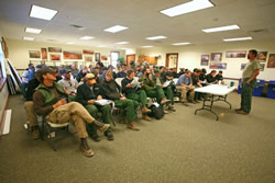
Morning briefing.
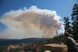
A visitor observes the prescribed fire smoke plume from an overlook.
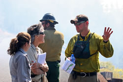
An information officer explains the fire to park staff.
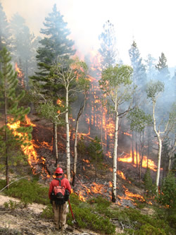
One purpose of the Puma Prescribed Fire was to modify forest structure.
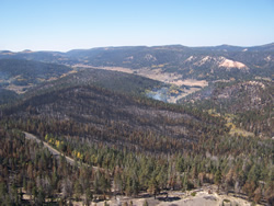
Aerial view of a portion of the burn unit.
After nearly five years of planning and preparation, the Puma Prescribed Fire (Rx) finally came to fruition in September 2008. The largest prescribed fire in Bryce Canyon National Park’s (NP) history was truly an interagency effort as the park collaborated the planning and implementation of the burn with the adjoining Dixie National Forest (NF). Not often, do fire management programs attempt prescribed fires that cross agency jurisdictional boundaries due to the complications associated with often-differing policies and management objectives. However, Bryce Canyon NP and the Dixie NF showed that through a coordinated interagency effort successful results could be achieved for both.
The Puma Prescribed Fire Burn Unit is located in the southern portion of the park near mile marker 13 on Highway 63 and continues to Rainbow Point at the end of the park road. The project area treated included 2,073 acres in the park and 2,019 acres on Dixie NF lands. This project was designed to increase visitor safety by the reduction of hazardous fuels along the park highway through modification of the forest structure. Secondary goals were to reintroduce fire to its natural role in the ecosystem and thus open the forest canopy and forest floor to promote the regeneration of ponderosa pine, quaking aspen, and other native species.
This first entry burn (the area had not seen fire for nearly 100 years) treated the approximately 4,100 acres in two phases. The first phase was a 234-acre hand ignited blacklining operation along the park’s main highway to provide a pre-burned buffer for the ignition of the interior of the unit. The second phase was a combination of aerial and hand ignition of the rest of the burn unit, located below the park highway to the west. Weather conditions before and during the fire were closely monitored to ensure that the burn occurred under a predetermined set of conditions.
This project was carried out with close support and cooperation from the Dixie National Forest whose lands surround most of the park. Over 45 firefighters and associated equipment from the National Park Service and U.S. Forest Service cooperated to implement the burn.
The dispersal of information before and during the prescribed fire was critical to its success. Local citizens and business owners were contacted and made aware of the park’s proposed burns through a public meeting, press releases, phone calls, and personal visits. Information flow continued during the burn, with a number of information officers stationed along the park road and at other critical locations both within and outside of the park to keep local residents and visitors informed about the progress of the burn.
Smoke from prescribed fires is always a concern for local residents of the Bryce Canyon area. Not only for health concerns, but also its effect on the tourism industry which is the main economic driver in the area. Mitigation measures were implemented to reduce the impacts of smoke such as only burning under weather conditions that allow for good smoke dispersal and not burning on busy weekends. Public input concerning smoke issues and the burns’ effects on visitation were utilized in the formation of the final planning documents for the burn. There were very few complaints from visitors or residents concerning the prescribed fire and the smoke associated with it. In fact, the fire provided many opportunities to educate the public about the need and reasons for prescribed fires on our federal lands.
The Puma Prescribed Fire was a great example of how agencies can work together to manage public lands across jurisdictional boundaries. Since fire and the vegetation that carries it does not adhere to these agency boundaries, neither should certain land management styles when it comes to dealing with fire-related concerns. By working together to create interagency burn plans, land managers can achieve results that may not be possible by using unit burn plans. These interagency efforts can also help to reduce prescribed fire costs, increase safety, and manage our public lands in a more unified manner.
The lack of natural fires in Bryce Canyon National Park and the Dixie National Forest over the past few decades has contributed to high fuel loadings and a change in forest structure. Prescribed fire is a treatment to reverse these changes brought on by fire exclusion. The policy of using fire as a tool will help decrease risks to life, property, and resources and will help perpetuate the values for which many of our public lands were established.
Contact: Bruce Fields, Fuels Specialist, (435) 834-4912.