

National Fire Plan Success Story
WFMI Data Cleanup Improves Planning and Decision Process
Southeast Region, Georgia and North Carolina
National Fire Plan - Accountability
2010
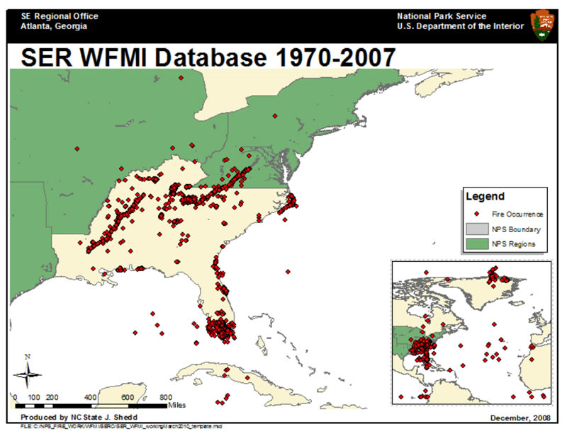
Before clean-up: Poor record-keeping and data entry resulted in nonsense mapping of hundreds of NPS fires in Iceland, the Gulf of Mexico and the Atlantic Ocean. Larger version of the map.
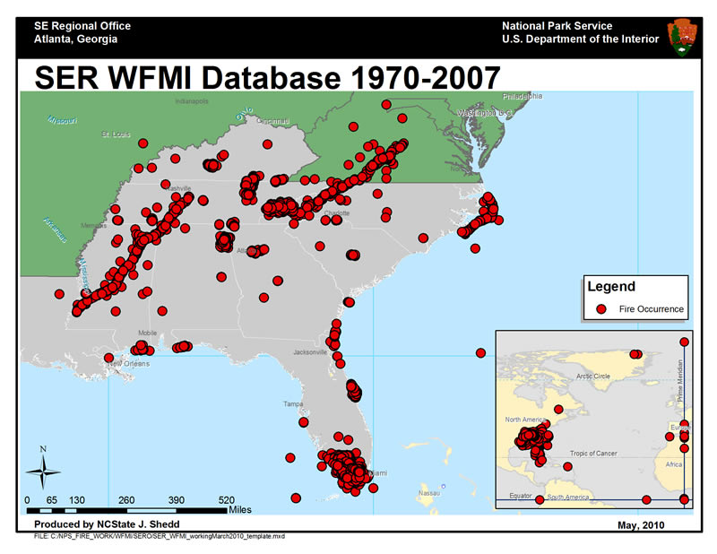
After clean-up: Firing Boss Jennifer Adams inspects the holding line at the edge of the burn. Jessica Vincent (background) and other firefighters use fire engines, pumps and hoses to prevent the fire from spreading to surrounding areas. NPS photo by Darrell Densel. Larger version of the map.
The painstaking detective work of verifying and updating the Southeast Region’s fire occurrence data found in the Wildland Fire Management Information Database (WFMI) is nearly complete. This process involved comparing fire reports, case incident reports, and local GIS data to WFMI data going back to 1970. To date, over 1,700 old fire records have been corrected for completeness and accurate spatial data.
Under the direction of Regional Fire Ecologist Caroline Noble, contractor Justin Shedd, a research associate from North Carolina State University, Raleigh, and Fire GIS Specialist for the Northeast, National Capitol, and Southeast regions of the National Park Service, has been working with regional office employees for several years on this project. Most recently, Shedd has been assisted by Shatiba Bradley, Southeast Region Fire Management Assistant in Atlanta.
The decision support systems that pull data from WFMI for analysis typically discard incomplete records. Therefore, Shedd and his staff first ensured all reports were as complete as possible. The next step was to find accurate locations for fire starts. Many fires had incorrect or nonexistent spatial information. Furthermore, fire origins were often lumped together whereby one spot would represent multiple fire occurrences. Finally, researchers entered fire occurrences that were missing from WFMI.
As online systems such as the Wildland Fire Decision Support System (WFDSS) and Fire Program Analysis (FPA) become increasingly important in planning budgets and program staffing, as well as responding to individual fires, the reliability of the underlying data used by these systems becomes critical. Attention to detail in the historical data will now enable better planning and decisions in the future.
Contact: Caroline Noble, Regional Fire Ecologist, (850) 893-4153 x267.